Country
Geolocation
POINT (2.3488 48.8534)
  • Sipping coffee in Sligo: How a commitment to community and attention to detail turned things around for downtown—one cup at a time

    Copy linkFacebookXLinkedInEmail
    Members of the Cities@Heart network
    06/12/2023
    07/12/2023


    The year is 2013 and few residents of Sligo, Ireland have heard of a BID, or Business Improvement District. Stakeholders in the local commerce sector operated independently and seldomly in cooperation with the County Council. Fast forward to December 6, 2023 when a group of 26 individuals from ten different countries all over Europe touched down in Sligo to glean best practices for city centre management. Sligo’s remarkable success story provided a fitting backdrop for the first transnational meeting of the Cities@Heart URBACT Action Planning Network.

    Ongoing

    Members of the Cities@Heart network and meeting attendees

    Network
    From urbact
    Off

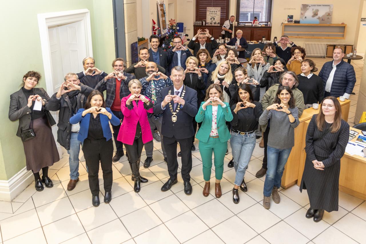
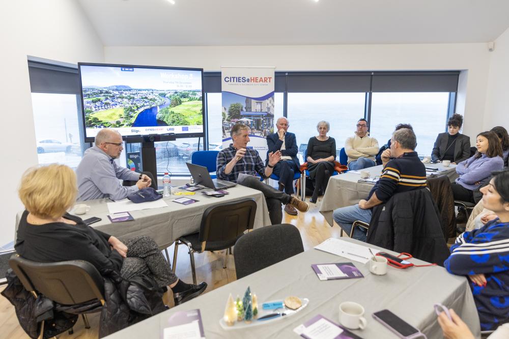
    Formed in 2023 and piloted by the Greater Paris Metropolis as Lead Partner, the network Cities@Heart brings together 10 different local governments working to create tools for the improvement of city centres. The first network-wide gathering since the URBACT IV launch in 2023, this transnational meeting was a new step in the network journey, an opportunity to exchange and to observe the policies of host partner Sligo County Council and Sligo Business Improvement District. Following 10 different Baseline Study Visits conducted by Lead Expert Mar Santamaria Varas, this meeting also represents the network’s shift from the preparatory to activation phase.

    Network Map

    Meeting in the Land of Heart's Desire

    The first transnational meeting provided project partners the opportunity to obtain feedback on their baseline study visit in the form of the presentation of an overarching methodology to ground the study and set the course for the following two years of inter-european collaboration.

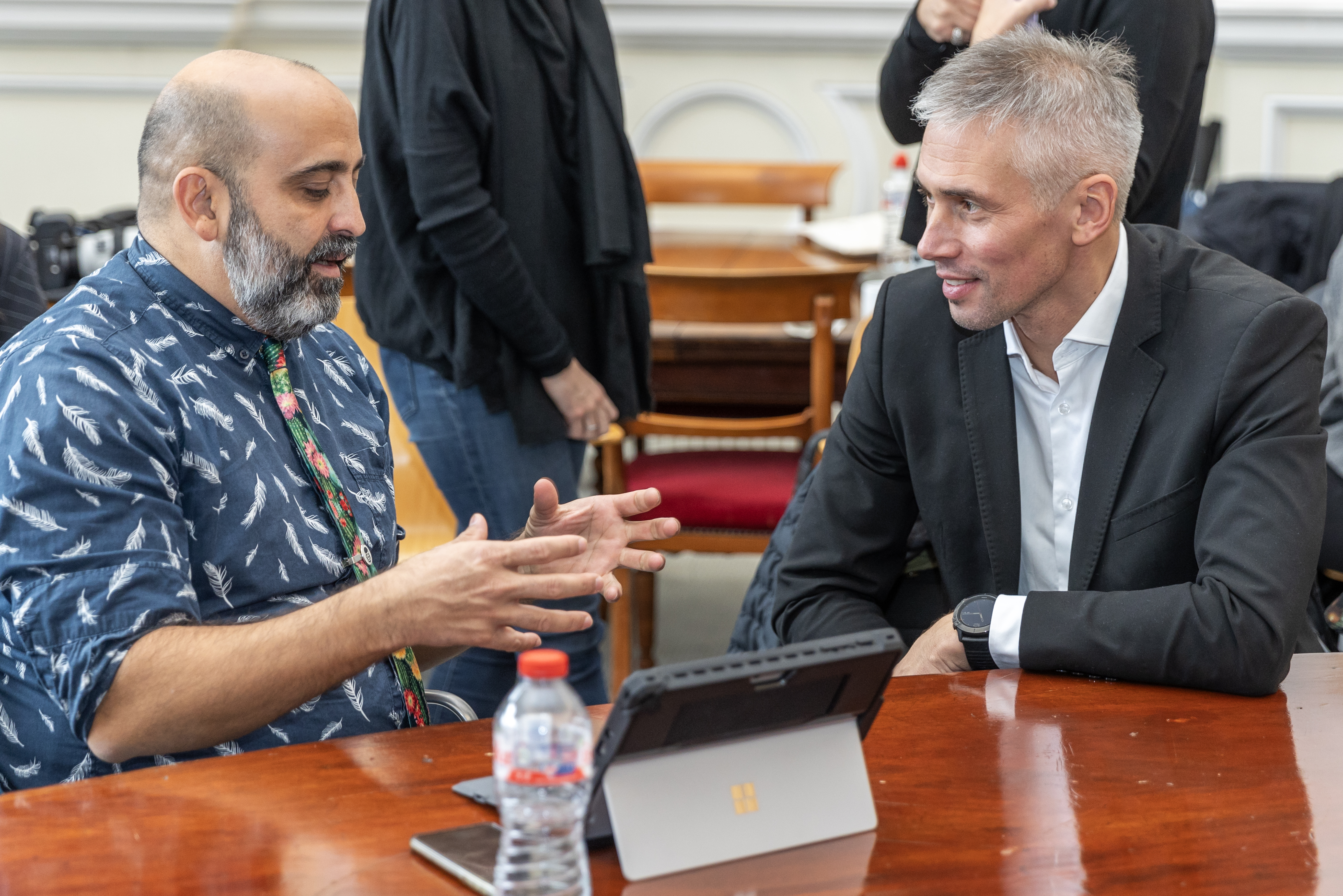
    To kick off the first morning of workshops, participants shared their experiences in the realm of public-private partnership. In Krakow (PL), the city approached the Wesoła District’s revitalization with workshops on prototyping solutions for shared spaces to build a sense of community and responsibility for its development among citizens. In Celje (SI), a vacant storefront was left to the use of local stakeholders, providing a successful brick-and-mortar testing ground for new ideas or projects. Back in Sligo, the public-private partnership has proved to be fruitful: the business perspective encourages an objective data-driven approach and the public sector can intervene to implement holistic policy improvements.

    Project partners participating in a morning workshop

    If we can make it in the city centre, we can make it anywhere

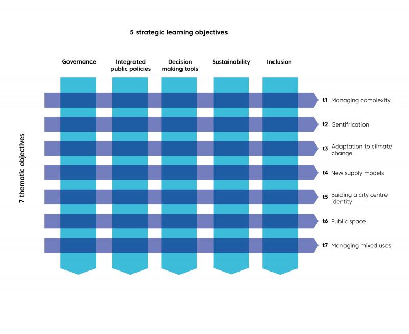
    A city centre is a microcosm of social functions and represents the most intricate iteration of urban complexity. While each project partner experiences their city centre in a different way, the network Baseline Study represents the structure of all city centers using a matrix contrasting 7 challenges with 5 indicators.

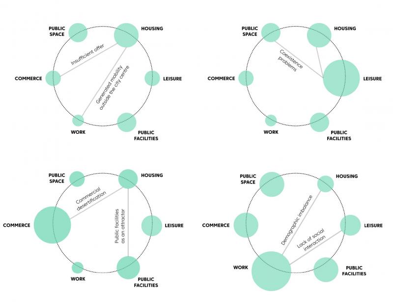
    From metropolises like Greater Paris (FR) or Krakow (PL)  to smaller cities like Fleurus (BE), for each partner, the diverse challenges may be more or less acute depending on the local context and the means available. Indeed, an imbalance in one of these topics or challenges can greatly aggravate the local context in the city centre, as evinced by the diagrams below.

    Network tool

    To showcase Sligo’s strengths and best practices, the meeting focused on the management of data and local commerce in the city centre. Sligo is a lovely town nestled in a blustery corner of northwest Ireland, minutes from the Atlantic Coast and known for being a literary “land of heart’s desire” with poet W.B. Yeats as a native son. Yet, none of these attributes bring to mind words like “innovation” or “world renowned”. Public policy in Ireland is centralised in Dublin and towns “west of the Shannon” are considered out of the purview of the national stage. In fact, Sligo had historically been “left behind” by urban development schemes deployed elsewhere in the Republic of Ireland.

    Urban solutions with a human approach

    This brings us back to the coffee anecdote… After living and working abroad in the U.S.A. and Australia, Sligo native Gail McGibbon decided to return home. In order to start what would become Ireland’s fourth BID, Gail McGibbon went to work in a seemingly slow way: meeting for a cup of coffee with likely every single business owner in the town, having no other overt objective than sharing a chat. In her seminal work, The Death and LIfe of Great American Cities, Jane Jacobs posits, “there must be eyes upon the street, eyes belonging to those we might call the natural proprietors of the street." While this declaration has taken on a “big brother” connotation since the book’s publication in 1961, the principle rings just as true today. In every city centre, there is a need to be aware of what is happening in the street and with our neighbors or shopkeepers to make sure all are safe and provided for. Indeed, neighborliness proved to be the perfect ingredient to kick-starting the town’s transformation.

    As Chief Executive Officer Martin Lydon explained, in a post-pandemic society, Sligo is leveraging cultural shifts to become a destination for young professionals, students and families seeking proximity to nature and a high level of services. Looking to attract a pool of potential inhabitants keen on finding property in the more affordable western coast of the country, Sligo has invested in a place branding campaign, infrastructure to increase connectivity and the tourism sector, inaugurating their National Surf Centre and a network of cycle paths.

    Turning the local economy around

    Now in 2023, the Sligo BID is healthy and counts 758 members. The BID and Sligo County have worked together tirelessly to introduce innovative measures for data collection, property management, tourism policy and event nightlife. Sligo has developed a Welcome Ambassador Programme, won the Purple Flag Award for night time economy, the label of Coach Friendly Destination and continues to attract international visitors curious about the town’s policies. In the end, Sligo’s shortcomings would eventually become strengths. The lack of urban sprawl meant that the town and county could promote closeness to nature and life at a human scale. The local counter-culture turned out to be a good thing for the health of the town’s high street district.

    Project partners visit the city centre


    The human-ness at the origins of Sligo’s strategy is well reflected in the national Irish Town Centre First strategy which is based at the LGMA and places pragmatism and open dialogue at the forefront. One of the measuring tools of the programme, the Town Centre Health Check Programme, is a public document that serves as an objective evaluation of the town’s progress in implementing best practices. National Coordinator Mairead Hunt presented the country’s policy at the transnational meeting in Sligo and highlighted three core principles: understanding the place, defining the place and enabling the place. The national meeting of Town Regeneration Officers shies away from speeches by elected officials and focuses on peer-to-peer learning.

    Soft approach, hard data

    And yet, Sligo’s strategy didn’t stop at a friendly chat. The county and BID got to work monitoring, measuring and adapting their strategies. Brían Flynn, Town Regeneration Officer, presented the town’s creative use of data in developing their policies. In 2023 the Irish business platform GeoDirectory released data on commercial vacancy in the country. At 25.4%, the rate in Sligo was listed as the highest in the country. In order to curb the negative press and further investigate the truth behind this report which seemed incomplete to local officials, the town decided to collect its own data in the form of a comprehensive land-use policy survey. The study is still being carried out but the town has already gained valuable knowledge on the vacancy profile of downtown property and 16 landowners have discovered the national Croí Conaithe scheme for refurbishment of vacant buildings.

    Brían Flynn presents Sligo’s data policies

    In turn, after witnessing Sligo policies first-hand through a series of site-specific visits and presentations, the network conducted a workshop on the subject of information gathering to address issues all along the chain of data management: identifying data sources, collecting data and data governance. While obtaining data can be simpler than expected, data-driven policy requires vision and advanced planning in order to identify independent sources of information and a successful, manageable tool for translating data into actionable proposals for city improvement.

    Network partners enjoy a performance of traditional Irish music at the Tourism Bureau

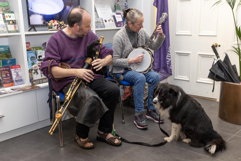
    An inaugural meeting for the network and for new URBACT participant Sligo, the event was opened by Cllr. Gerard Mullaney, Cathaoirleach of Sligo County Council and attended by Irish National URBACT Point Karl Murphy and Kristijan Radojčić of the URBACT Secretariat. The meeting was drawn to a close with a hike to glimpse the breathtaking vistas at the summit of the Knocknarea rock formation, providing a bird’s eye view of the Atlantic coast and the Sligo town centre.

    Network partners hike the Knocknarea rock formation

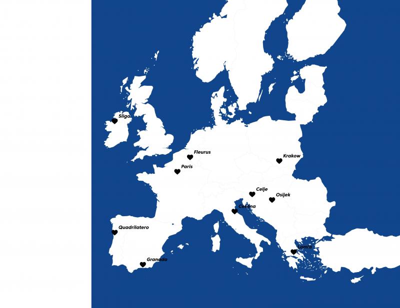
    With one meeting completed and the new year well on its way, the URBACT Cities@Heart network has three transnational meetings planned in Granada (ES), with the Quadrilatero Urbano Association (PT) and in Cesena (IT). Ensuing transnational meetings and those of Urban Local Groups (ULGs) will allow the network to share learnings and experiment small-scale actions over the next year.

    Network members :

    • The Greater Paris Metropolis, France
    • The City of Cesena, Italy
    • The City of Granada, Spain
    • The City of Osijek, Croatia
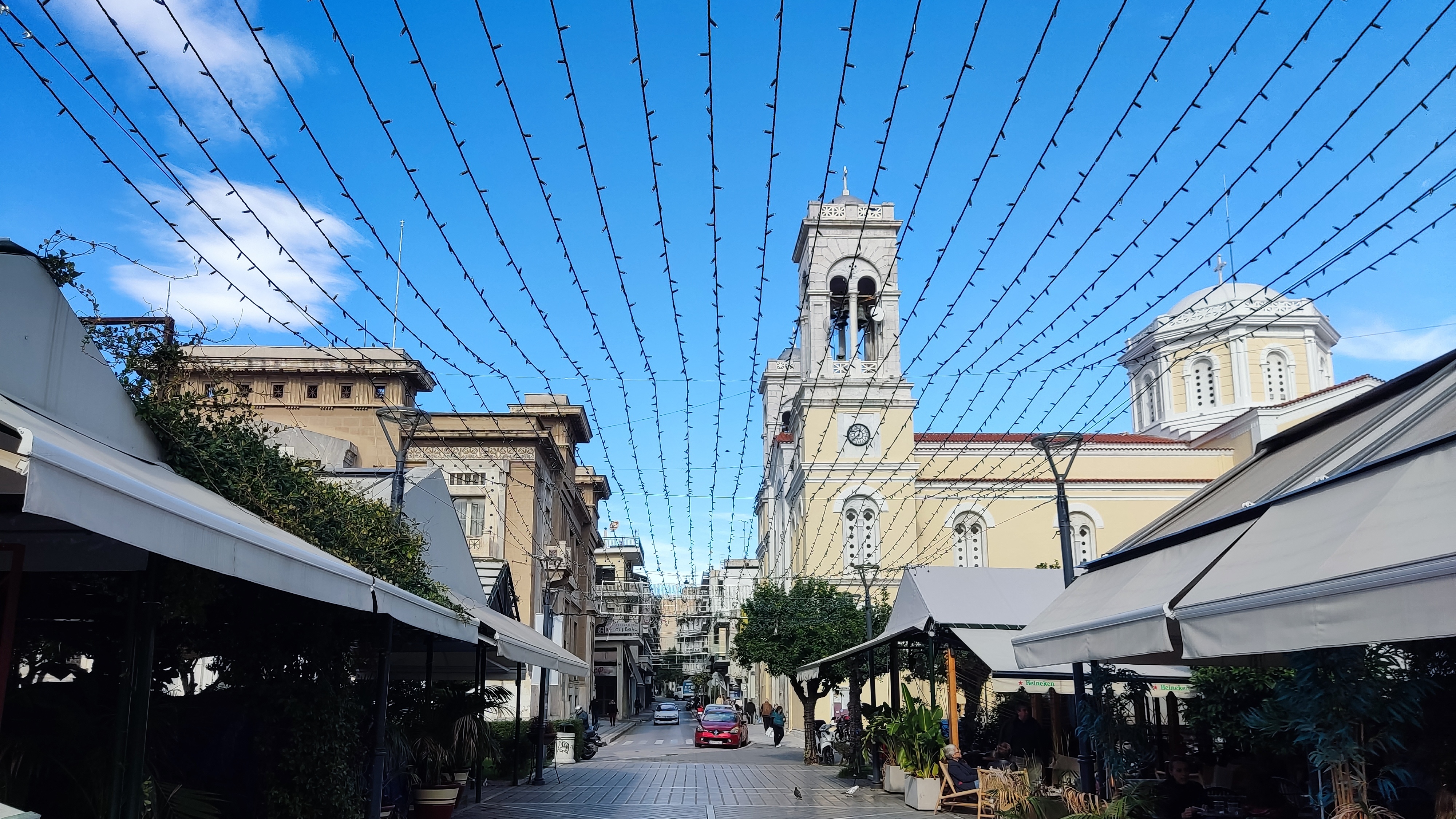
    • Amfiktyonies, a business development organization representing the City of Lamia, Greece
    • The City of Celje, Slovenia
    • The City of Fleurus, Belgium
    • The City of Sligo, Ireland
    • The Krakow Metropolis Association, Poland
    • The Quadrilátero Urbano Association, Portugal


  • Falling in love with downtown: the URBACT Cities@Heart network is here!

    Copy linkFacebookXLinkedInEmail

    As a part of the URBACT IV European Programme, ten European urban areas come together to form Cities@Heart, a network dedicated to sharing best practices and innovations for improving city centre management.

    News

    Osijek, Croatia

    Network
    From urbact
    Off

    Having a chat with your neighbourhood baker, running into an old friend, finding all you need in one place: these are just some of the reasons why we feel so attached to our city centres. However, today in the 21st century, city centres are facing more than just a little competition. From the rise of big-box stores and franchises to the omnipresence of online commerce, downtown areas have lost some of their edge. A result of urban sprawl and rising property values, the spatial fragmentation of our cities further strains the resilience of the high street. Amid all these challenges, city centres are well worth understanding, defending and improving. That’s where the URBACT Cities@Heart Action Planning network comes in.

    A programme supported by ERDF funds from the European Union, URBACT promotes sustainable urban development in Europe’s cities, both big and small. This year marks the beginning of URBACT IV, the fourth iteration of the programme with the launch of 30 Action Planning Networks throughout Europe and IPA countries. Harnessing an understanding of governance and recognizing the transverse coordination between the public, private and civic sectors as a driver for change, Cities@Heart partners will work together with a data-driven approach to plan, monitor and evaluate the implemented policies in the urban core. For the next 2.5 years, Cities@Heart will mobilise ten European urban areas. Network partners will work together to understand the way city centres function and create new monitoring tools to be used in city centre improvement initiatives.


    The Greater Paris Metropolis (Métropole du Grand Paris, France) coordinates the network in the role of Lead Partner. With a strong track record in downtown revitalisation policy, The Greater Paris Metropolis is a public entity representing 131 cities in the French capital region including the city of Paris. Endowed with extensive experience in local economy, architecture and urban planning, Barcelona-based Mar Santamaria Varas will assist the network as Lead Expert.

    The ten network partners include:

        The Greater Paris Metropolis, France (Lead Partner)
        The City of Cesena, Italy
        The City of Granada, Spain  
        The City of Osijek, Croatia
        Amfiktyonies, a business development organisation representing the City of Lamia, Greece
        The City of Celje, Slovenia
        The City of Fleurus, Belgium
        The City of Sligo, Ireland
        The Krakow Metropolis Association, Poland
        The Quadrilátero Urbano Association, Portugal

    Celje, Slovenia

    Each partner in the network is facing their own challenges: loss of inhabitants to the peripheries or the metropolitan areas, underdeveloped local commerce networks, conflicts generated by the intensive use of public space, the transition to walkable and carless environments, gentrification and over-tourism, gender equality and inclusion... Yet, all partners can agree on one thing: city centres are unique places and not just because they hold a certain affective charm: they truly are the lifeforce of our urban societies. Keeping the heart of downtown healthy is key to ensuring the vibrancy of local economies and the well-being of inhabitants.

    During the network’s lifespan, project partners will have the opportunity to travel throughout the European Union to see first-hand examples of city solutions driving change for better cities as they take part in transnational meetings hosted by the different project partners. To kick things off, the URBACT Secretariat hosted Summer University in Malmö, Sweden this past 28-30 August. Here, project partners met for the first time to discuss the framework of their networks, building capacity and learning more about the URBACT methodology for better cities. 

    Over the course of the autumn months, Lead Expert Mar Santamaria-Varas has travelled with the Greater Paris Metropolis to visit the ten project partners spread out across the European Union. From Poland to Greece, from Croatia to Portugal, the recent mobilities have provided a wealth of insight for this network of urban areas. The first transnational meeting of the network is planned for 6-7 December in Sligo, Ireland. After completing the Baseline Study Visit with Project Partners, the findings will allow the network to go from knowledge to action, laying out the roadmap for the next two years.

    With activities well underway, Cities@Heart is off to an exciting start. Check in regularly with the LinkedIn Page and the URBACT network webpage to stay up to date on project mobilities and findings!

  • Cities@Heart: an URBACT Network proposing solutions for city centres, the testing ground for addressing future urban challenges

    Copy linkFacebookXLinkedInEmail
    Baseline Study visit in Charenton-le-Pont, France

    In spite of urban sprawl and a franchise economy, city centres are on the rise! Cities@Heart is here to defend proximity and mixed use, making downtown more accessible and appealing for new generations.

    Articles

    Baseline Study visit in Charenton-le-Pont, France

    Network
    From urbact
    Off

    Cities@Heart is an URBACT Action Planning network bringing together ten urban areas from all across Europe. With three different time zones, contrasting demographics and over 12 official languages, the Cities@Heart network draws upon a diverse pool of urban professionals, civil servants and citizens dedicated to improving their downtown areas. Taking the form of an observatory, the network employs a broad approach to improving city centres. Rather than focusing on one aspect of local economy or urban planning, Cities@Heart is working to develop a tool to measure factors contributing to the success of city centres in places as diverse as Sligo, Ireland or Lamia, Greece, two of the project partners.

    A network to rethink public policies, governance models and decision-making tools for city centres

    As a response to this multifaceted challenge of city centre management, Cities@Heart proposes the creation of a shared methodology applicable to different types of urban contexts. Relying on a bottom-up approach integrating data management, this accessible, user-friendly framework will support decision-making processes as well as the implementation and efficiency of cross-cutting sustainable urban policies.

    The Cities@Heart methodology is based on five fundamental pillars:

    Governance: exploring existing models of town centre management (public vs. private, formal vs. informal) and new paradigms of participatory agreements among stakeholders in the form of multi-level partnership

    Integrated Public Policies: deploying policies that cut across multiple policy domains (housing, public services, mobility, public space, commerce, etc.)

    Decision-Making Tools: integrating data and indicators to support the analysis, formulation, and monitoring of implemented actions

    Sustainability: ensuring urban centres can adapt to climate change despite facing greater difficulties in comparison to the rest of the city (such as scarcity and limited space in public areas, a poorly maintained built environment, household incomes incapable of coping with transformation, etc.).

    Inclusion: providing optimal living conditions for all residents (regardless of gender, age, or background) and promoting personal autonomy through inclusive care

    Lamia, Greece

    The ten network partners include:

        The Greater Paris Metropolis, France (Lead Partner)
        The City of Cesena, Italy
        The City of Granada, Spain  
        The City of Osijek, Croatia
        Amfiktyonies, a business development organisation representing the City of Lamia, Greece
        The City of Celje, Slovenia
        The City of Fleurus, Belgium
        The City of Sligo, Ireland
        The Krakow Metropolis Association, Poland
        The Quadrilátero Urbano Association, Portugal


    The Cities@Heart Baseline Study

    Within the context of the URBACT methodology, each Lead Partner must conduct visits with the different partners comprising the network. These study visits allow the Lead Partner and Lead Expert to better understand the local context for each project partner all while revealing the commonalities shared across the network. During this phase, from June to December 2023, each partner in the network had the opportunity to host a visit in order to highlight their best practices but also their challenges: gentrification and over-tourism, adaptation to climate change, overuse or conviviality in the public space, improvement of local commerce networks and integration of new habits of consumption, creating a sense of belonging and identity, coordination between the public and private sectors or bolstering efforts for more inclusion and gender equality in the public space.

    Over the course of the Baseline Study, the network has also identified innovative solutions to these challenges in addition to methods for capacity building and scaling actions: collaborative models of town-centre management, data observatories and sectorial indicator tools, strategies to renovate listed buildings, greening initiatives for the public space, monitoring of tourism, revitalisation of vacant premises, night-life economy initiatives, creation of new commercial polarities around local markets or enlivening the city centre through festivals or citizen-based initiatives.

    Contextual Examples from the Network

    City centres have undergone significant changes in the past century. To understand the context of Cities@Heart, it is important to provide a brief historical background. With the advent of industrialisation, the early 1900’s witnessed the rapid growth of cities in Europe. These new metropolises developed and  gradually endowed themselves with new, more modern infrastructure and services. By the mid-20th Century, a phenomenon of urban sprawl could be observed, with peripheral, “sub-urban” areas offering a higher standard of living than the historic centres, then perceived as dense, unhealthy, and obsolete.

    However, starting in the second half of the 20th century, an awareness of the importance of historic centres began to emerge. European urban centres became a prominent target for urban regeneration initiatives. City centres started to be recognised for their crucial role in urban dynamics and social cohesion. From the 1970s, city management started directing resources to the historic centre. These oftentimes obsolete and abandoned central spaces gained prominence in spite of contradictory policies encouraging unlimited urban development in the preceding decades. In response to the renewed concern for urban areas, city centres are now poised to become the focus of urban transformation and revitalization initiatives.

    Today, city centres still represent an opportunity to address structural challenges in the transition to new urban models fuelled by the green transition and grounded in the principles of  proximity. As proposed by urbanist Carlos Moreno in the 15 minute-city paradigm, town centres have the potential to provide most essential services within a short walking distance: community-scale education and healthcare, retail, parks for recreation, working spaces and more. This hyper-local framework has the potential to generate dynamic local growth, stronger communities, viable businesses and commerce, active mobility, and in turn reduced emissions.

    However, the configuration of contemporary city centres also creates conflicting urban realities where several functions coexist in permanent tension. Transition can come at a price. A high quality of life in the city centre also requires healthy environments, efficient infrastructure, and easy access to amenities. In addition to basic everyday amenities , citizens also need to have opportunities to develop economic activities that increase wealth and social mobility. City centres are tasked with providing housing to a diverse population, prioritising affordable housing, catering to diverse socio-economic groups and fostering inclusivity, all while ensuring accessibility to public spaces that enrich communal bonds, promote well-being and create a sense of belonging.

    The Next Steps for the Cities@Heart Network

    The URBACT framework enables the transfer of knowledge on transnational and local levels, promoting capacity building activities, the development of local action plans together with stakeholders (the ULG or Urban Local Groups) and the dissemination of results with the aim to transfer this evidence-based and integrated approach to other urban contexts.

    An interdisciplinary, complex subject matter, city centres are certainly worth observing. Observing the core of the city provides insight to broader national and global trends. Addressing social and urbanistic issues in the city centre may in turn yield more positive effects on the greater urban area, creating more spaces for people to meet and create engagement in their communities. As the Cities@Heart Baseline Study comes to a close, the network partners are looking forward to two more years of collaboration, using the road map generated by the findings of this investigatory period.


  • Is the compact city model endangered?

    Copy linkFacebookXLinkedInEmail
    Is the compact city model endangered? Article COVER
    20/01/2023

    Three Action Planning Networks (2019 - 2022) came together to gather inspiration on how people can experience and move through the city.

    Articles
    Network
    From urbact
    On

    The Walk’n’Roll initiative, 27 different towns, cities and metropolises from the RiConnect, the Thriving Streets and the Space4People networks had a common mission. Together, they reflected about how mobility can play an important role when building better public spaces and increase the quality of life for local communities.  Iván Tosics, URBACT Expert who followed their exchange and learning journey, shares with us some of the key take-aways, findings and open questions that were raised during the Walk’n’Roll many and which are compiled in a brand new Guidebook. Take a ride with us and enjoy the read!


    URBACT Walk'n'Roll


    The recent pandemic was an important episode in the history of urban development. Much can be learnt from the immediate reactions to the health crisis, especially in dense cities. There were many brilliant examples about innovative tactical interventions in public space, inclusive housing policies, new types of economic support and social protection mechanisms, from which we can take stock.

    As the peak of the pandemic has slowly come to an end, the life in cities has quickly returned to its pre-Covid pace. A negative legacy is the incessant growth of suburbanisation, a process that has exploded over the last two years not only in Europe, but also in almost all parts of the world...


    A common effect in different cities


    In Oslo (NO), internal movements in and around the city, have shown an increased outmigration in the past two years with people aged between 25-30 and 60-70 moving away from the city, towards its outskirts and beyond. The “working from home effect” can partially explain this phenomenon. People with higher wages had a tendency to move away. It’s interesting to note though that most of the outmigrants were people who were not born in Oslo, according to studies.

    Likewise, in American cities, a substantial reallocation of housing and office demand has become tangible. People chose to move to the suburbs, away from dense city centres. Some analysts have called this as the “doughnut effect”. Meaning the rise of the suburbs and the slump of the city centre, driven by a fear of crowds and the opportunity of working from home.

    In a very recent analysis on the situation of the Paris urban area (FR), the academia has tried to collect all available information about internal residential migration, using unusual data. Information from rural associations, from the post office regarding permanent re-direction of mails to new address, or even schools' registrations were used as unexpected, yet rich sources. As evidence shows, migration flows from the downtown to the urban fringe are visible. According to this analysis, such movement of people cannot be considered as an urban exodus though. So, if not an exodus, what are these new forms of migration then?


    The new intra-urban migration tendencies


    First of all, research suggests that no direct, causal links exist between the spread of the virus and urban density. According to an OECD, it’s not density alone that makes cities vulnerable to Covid-19, but rather a mix of factors. The structural economic and social conditions play a role in this regard with overcrowdness, inequality, insufficient living conditions and the spatial concentration of the urban poor.

    The consequences from this new suburbanisation, on the other hand, are very clear: growing climate and energy problems due to increasing car-use, intensification of social disparities, since those who are leaving the city centre are the ones who can afford to do so. Moreover, there are also more and more problems in places where people tend to move out from. In the Budapest area (HU), for example, there are growing complaints in the agglomerational settlements with physical and human infrastructure problems, caused by the quick, unplanned growth of new residents.

    That being said, the post-Covid city presents us with a silver lining, an opportunity to rethink the principles of the urban compact development. For instance the British professor, Greg Clark, offers us a vision with blended cities and a more spread planification process. He argues for a wider distribution of activities between urban areas to offer second and third tear cities more chances. He also makes the case for better disposition of services within functional urban areas, based on the growth of "neighbourliness" and the emerging social capital.  

    Clark argues that people living in the fringes might still travel to the larger city centers from time to time, and acknowledges that they might not always work from home. At the same time, they will also get a taste for the local life where they live. People will spend more time – and money – in their neighbourhoods and, by consequence, new opportunities might arise for towns, suburban and secondary downtowns. So, these are not simply places where people sleep and work from home, but also places of exchange and for gatherings. Where, eventually, communities might thrive.

    This idea raises challenges for future urban development, for instance, issues related to metropolitan planning. Where to build new housing and dwellings? And how to regulate transport fares? These are just a few of the questions that were discussed during the Walk’n’Roll conference in Barcelona (ES), held in July 2022. The findings are summarised below.


    How to improve existing dense areas?


    The most widely accepted definition for adequate urban density is the one that acknowledges the need for an accessibility shift: changing urban transportation and land-use planning on the basis of people's ability to reach destinations, rather than on their ability to travel fast. This vision relies on the principle of re-humanising cities.


    The proximity aspect


    In the Walk’n’Roll conference the topic of proximity was at the heart of the discussion. In order for residents to give up the frequent use of car and, in perspective, also the ownership of a car, urban areas have to be changed. They must allow people to reach the most important everyday-destinations in a short time on foot, by bicycle or using public transport rides. There are many ideas raised for this shift, like the concept of the 15-Minute city. Besides the innovative practices of superblocks, Tempo30 and parking management – which are thoroughly described in the Walk’n’Roll Guidebook, Booklet 2 – you can find below two other ideas.


    The pedestrian-priority city


    Pontevedra (ES) is a medium-sized city with 83 000 inhabitants. In 1999 it was just another car-oriented city, but things started to change with the election of a new mayor – who still holds this position until this day. Mr Miguel Anxo Fernández Lores told citizens back then that the act of buying a car didn’t magically grant people with 10 square meters from the public space for a parking spot.

    His ideas consisted of making a distinction of the need for mobility, according to social criteria. He put people in the foreground, with at least half of the surface of all original streets turned into pedestrian areas. Intersections without lights and raised promenades were created, alongside he limited of parking hours in the downtown to a maximum of 15 minutes. In addition, underground parking was built under a concession and free public parking spaces were provided within a 15-20 minute walk of the centre.

    The results of these interventions were staggering: a decrease of motorised traffic by 77% in the dense urban area and by 93% in downtown, besides a decline in traffic accidents with no fatalities at all. Pontevedra became a high quality place to live with all public spaces serving the people, instead of the cars.


    Car-free places in every neighbourhoodURBACT Walk'n'Roll


    Back in 2014, in collaboration with 24 parish councils, the municipality of Lisbon (PT) started a programme called “Uma Praca em Cada Bairro” (“A space in every neighbourhood”). Currently being implemented, the programme is helping to renovate areas in the city to get people out of cars and to create new public spaces. The squares and streets will become the meeting point of the local community and “microcentres”, concentrating activity and employment.

    Henceforth, walking, cycling and public transport will be favoured, as the car traffic will be significantly restricted. The citywide programme in 150 squares and streets, practically in all neighbourhoods of Lisbon, could only be carried out with the support of the population. The programme counted with strong public participation processes.


    Potential externalities of public space improvement policies


    It goes without saying that the improvement of living conditions, with more public spaces and fewer cars, can lead to raising rents, pushing the most vulnerable residents away from the city. This is why it’s fundamental for the public sector to control the gentrifying effects. The efficiency of the public intervention depends on the willingness and political power of the municipal leadership, as well as on the housing system of the given city. A good example is the city of Vienna (AT), where the majority of the housing stock is under direct or indirect public control, with little or no gentrifying effects as a consequence of mobility and public space improvements.

    The situation is slightly more difficult in Barcelona, where the share of rental housing represents 31% of the housing sector. Only a small portion of these houses is actually owned by the public sector, making it almost impossible for the municipality to defend tenants. To tackle this challenge and avoid a “New York Highline effect”, the municipality provides subsidies to the urban poor, regulates private rents, oversees the housing market and even negotiates with landlords.


    How to create efficient metropolitan cooperation in blended cities?


    In the post pandemic world it’s not enough to make the dense urban cores more attractive, attention has also to be paid to those peripheral locations where many families aim to move to. Planning in larger territories can bring to light different questions, as to where new housing stock should be constructed or how to regulate and tax different forms of transport. The key aspect for public intervention in wider territories is a metropolitan coordination, which can be illustrated by the examples below.


    Turning highways into urban boulevards


    The classic period of suburbanisation started in the late 1950s in the USA, with the construction of 40 thousand miles of motorways financed by enormous central state grants. Urban planners were unstoppably carving highways into the urban structure, eradicating vulnerable neighbourhoods with fewer abilities to resist and, finally, ensuring the separation of functions following the leading planning concepts of the time. A similar car-oriented “modernisation” wave also reached most of the European cities. During the Walk’n’Roll conference, city practitioners showcased examples of recent efforts to reverse this phenomenon.

    In the course of the work done by Metrex for the From Roads to Streets learning platform –with support from Eurocities and URBACT – many European cases are analysed, including the transformative strategies adopted in Helsinki (FI), Oslo (NO), Lyon (FR) and Brussels (BE). In these dynamically growing cities the leading model is the urban intensification to concentrate growth and avoid urban sprawl. One way to achieve this principle is to direct new development to areas along the highways – provided that these are transformed into urban boulevards, with more space given for non-motorised vehicles. In Utrecht (NL), for example, two alternative projections were calculated for future scenarios and, according to them, the "A Proximity Model" foresee 20% less car-use.

    The opportunities and challenges of these new urban boulevards are gathered in a project to humanise the N-150 road, which is the central element of Barcelona’s Integrated Action Plan for the RiConnect network. This project deals with the motorway-like national road at the fringe of the metropolitan area, which created a division between the settlements and was putting the speed of mobility as the top priority. In order to restore old connections between the peripheral municipalities, the concept of metropolitan roads was born: without building new roads the extinct links between areas should be revived. This shall calm down traffic on the national road and even enable people to cycle from one town to another, which was not previously possible with the highways.


    URBACT Walk'n'Roll


    Improving the rail network to ensure metropolitan cooperation


    The Krakow (PL) Integrated Action Plan for the RiConnect network shows another way how metropolitan cooperation can be created. The Skawina Mobility Hub aims to create a connection point in one of Krakow’s satellite cities, on the line of the fast speed agglomerational railway that is under construction.

    Besides exploring the future functions of the evolving mobility hub, the intermodal links, park and ride (P+R) facilities and how to connect the station with city centre of Skawina, many efforts are being made to change the mobility mindset of people. This includes co-creation workshops, which resulted in the establishment of the integrated ticket system.

    Krakow is a good example for bringing public transport to the overall reflection on the metropolitan area. Such strategies, however, have to face the financial challenge of running public transport. During Covid times the ridership of public transport decreased almost everywhere and the rebouncing is still slow.


    Bringing planning and governance together at metropolitan level


    The Metropolitan Area of Barcelona (AMB) is a great example of how planning and governance can come together, not only at city, but also at metropolitan level. The AMB, the Lead Partner of the RiConnect network, is an agency with competencies in terms of mobility and public space in the metropolitan area – which counts with the double of inhabitants in comparison to the city itself. AMB is managing a very innovative mobility plan covering different aspects, such as generating safe and comfortable spaces for pedestrians, and sustainable methods of mobility, while reducing the use of private motorised transport.

    Unfortunately, not all cities have powerful metropolitan governance systems and/or strong agencies for planning and mobility. In the lack of these, urban planning cooperation between the municipalities of the urban area can help a lot. Sometimes these are initiated in bottom-up process, in combination with the national level, in order to use efficiently the EU Cohesion Policy resources. The Kraków Metropolitan Area (KMA), for instance, is responsible for coordination of transportation investments, which are implemented in the Integrated Territorial Investment (ITI) framework for the city and and its 14 surrounding municipalities.


    How to move towards an accessibility shift?


    Action Planning Networks labelThe new Walk’n’Roll Guidebook is split in three booklets – WHY, WHAT and HOW – and brings to light solutions that any city, regardless of its size, can use as a reference to drive change towards more blended and less compact cities. In order to tackle the most recent challenge of post-Covid suburbanisation, however, the practical interventions that are presented have to be combined with territorial visions. Regulation, planning and the support of governance institutions are equally important. Although this might sound challenging, there are different resources that can be particularly useful. Take for instance the EU Cohesion Policy, where investments in urban transport have more than doubled – from 8 billion EUR in 2007 - 2013 to 17 billion EUR in the 2014 - 2020, with even more opportunities in the next programming period.

    The first URBACT IV (2021 - 2027) call for Action Planning Networks is also a great occasion for cities to find partners to exchange, pilot ideas and develop an integrated set of actions at local level. While URBACT stresses the importance of the priorities of green - gender - digital, the RiConnect, the Thriving Streets and the Space4People networks are living proof of the wealth of themes that can be tackled within the spectrum of any urban subject, as today’s mobility challenge. These projects are in the crossroad of building more inclusive cities – for women and all – while also promoting the reduction of carbon emissions.

    Cities that wish to apply to the call are welcome to choose whichever network topic they deem relevant to their context. URBACT welcomes – and always will – bottom-up approaches that look at the big picture. Walk’n’Roll is bear fruit of the past round of Action Planning Networks and, hopefully, the next batch of URBACT cities will carry on its legacy and put its knowledge into action.

    URBACT Walk'n'Roll Guidebook